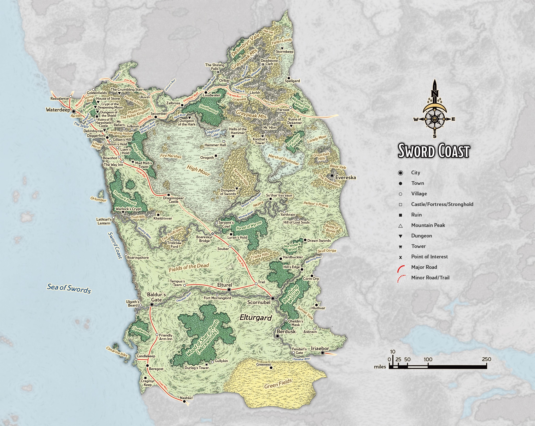
Sword Coast Campaign Region
Primary campaign region for Knightmare of the Sword Coast, including Waterdeep, Baldur’s Gate, Candlekeep, Dragonspear, Elturel, Daggerford, Nashkel, and the surrounding roads, forests, marshes, and ruins.
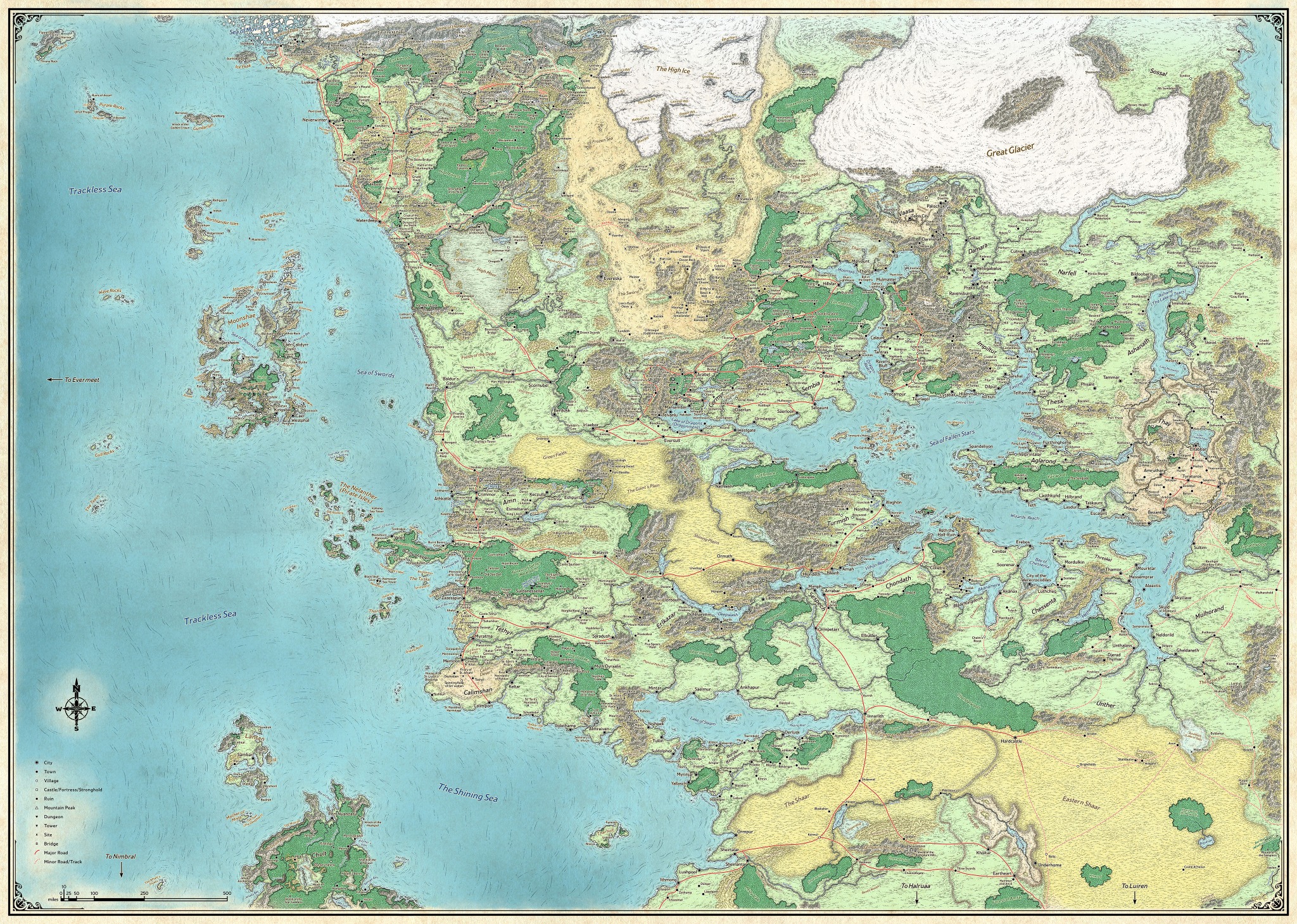
Maps and travel aids for the campaign. Upload only versions safe for the current party.
These maps are player-facing references for the campaign. They are provided for travel orientation, regional context, and general geographic memory.
These maps do not mark Arkhavelra’s hidden network, lieutenant lairs, unrevealed ritual sites, or future module structure.
Primary campaign region for Knightmare of the Sword Coast, including Waterdeep, Baldur’s Gate, Candlekeep, Dragonspear, Elturel, Daggerford, Nashkel, and the surrounding roads, forests, marshes, and ruins.
Broader regional reference for the western and central Realms, useful for understanding how the Sword Coast relates to the Heartlands, Moonsea, Dalelands, Sea of Fallen Stars, and the southern kingdoms.